Severe Weather Alert: Trough of LPA Brings Heavy Rains and Flooding Risks to Mindanao and Palawan
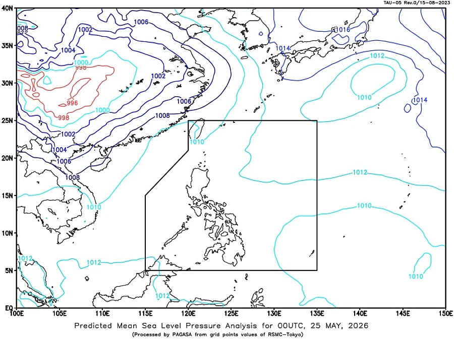
A low-pressure area (LPA) is currently affecting southern portions of the Philippines, bringing cloudy skies with scattered rains and thunderstorms to large parts of Mindanao and Palawan. The Philippine Atmospheric, Geophysical and Astronomical Services Administration (PAGASA) has issued a severe weather alert, warning of moderate to heavy rains that may trigger flash floods and landslides in vulnerable and low-lying areas.
According to PAGASA's 4 a.m. weather bulletin on Monday, the trough of the LPA is the primary cause of the inclement weather. The trough is an elongated area of low atmospheric pressure that can bring significant amounts of rainfall to affected areas. The agency has advised residents in Mindanao and Palawan to be prepared for the possibility of severe weather, including flash floods and landslides.
The Bicol Region and Quezon are also expected to experience partly cloudy to cloudy skies with isolated rain showers or thunderstorms due to the easterlies. PAGASA has warned that severe thunderstorms in these areas may cause localized flooding or landslides, particularly in areas with rugged terrain or loose soil. Metro Manila and the rest of the country can expect partly cloudy to cloudy skies with isolated rain showers or thunderstorms brought by localized thunderstorms, especially in the afternoon or evening.
Coastal conditions are also expected to be affected by the severe weather. PAGASA has reported that Visayas, Mindanao, and Palawan will experience light to moderate winds coming from the northeast to northwest, with slight to moderate seas ranging from 0.6 to 1.5 meters. Northern Luzon will have light to moderate winds from the southeast to south, with coastal waters remaining slight to moderate at 0.6 to 1.5 meters. The rest of Luzon, meanwhile, will have easterly to northeasterly winds with coastal waters ranging from 0.6 to 1.2 meters.
The Philippines is no stranger to severe weather, with the country experiencing an average of 20 tropical cyclones per year. The country's geography, with its rugged terrain and extensive coastline, makes it prone to natural disasters such as floods, landslides, and storm surges. It is essential for residents to stay informed and up-to-date with the latest weather forecasts and warnings to stay safe during severe weather events.
PAGASA has been working to improve its weather forecasting capabilities, including the use of advanced radar systems and computer models. The agency has also been conducting regular drills and training exercises to enhance its response to severe weather events. Despite these efforts, it is still crucial for residents to take an active role in preparing for and responding to severe weather, including having emergency plans and supplies in place.
Summary Points
The trough of a low-pressure area (LPA) is affecting southern portions of the Philippines, bringing heavy rains and flooding risks to Mindanao and Palawan
PAGASA has issued a severe weather alert, warning of moderate to heavy rains that may trigger flash floods and landslides in vulnerable and low-lying areas
The Bicol Region and Quezon are expected to experience partly cloudy to cloudy skies with isolated rain showers or thunderstorms due to the easterlies
Metro Manila and the rest of the country can expect partly cloudy to cloudy skies with isolated rain showers or thunderstorms brought by localized thunderstorms, especially in the afternoon or evening
Coastal conditions are expected to be affected by the severe weather, with light to moderate winds and slight to moderate seas expected in various parts of the country